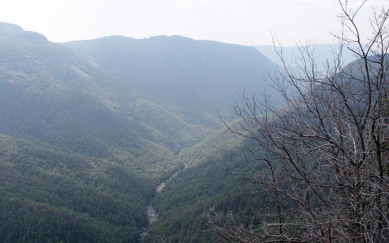
The loggers looked down and kept moving. What they passed over is still there.
The Linville Gorge cuts through the southern Blue Ridge along the eastern flank of the escarpment, where the Linville River drops roughly 2,000 feet over about twelve miles before it reaches the piedmont below. The walls on either side rise to Table Rock and Hawksbill on the east, to Linville Mountain on the west — quartzite and gneiss, Precambrian rock that was already ancient when the Appalachians began to be mountains. The rock records pressures and temperatures from far below the surface. That it is now exposed at a ridgeline tells you how much material has been removed from around it.
The gorge itself formed because the river found a weakness and stayed with it. As the land lifted over millions of years, the Linville River kept cutting, and the walls kept rising relative to the channel. The result is a slot in the landscape that averages about 1,500 feet deep in its central section — steep enough that slopes approaching vertical are common, shallow enough at its narrowest stretches that sound carries from one wall to the other.
Linville Gorge is one of the few large tracts in the southern Appalachians where old-growth forest survived the timber era. The reason is mechanical, not sentimental. Logging in the region ran on a simple logic: you needed to get trees out. The standard tools were splash dams to float timber down rivers, or rail lines cut up drainages, or skidders that dragged logs to landings. None of those worked inside a gorge this steep. The slopes broke equipment, slid material, and offered no flat ground for operations. The timber companies came to the rim, looked at the grade, and calculated that the board-feet per acre didn't justify the cost and the mortality rate.
The gorge thus survived not because anyone protected it early but because it was unworkable. The trees that were there in 1900 were, in many places, still there in 1950. By the time federal wilderness designation arrived — the Linville Gorge Wilderness was designated in 1964 under the Wilderness Act, making it one of the original units designated when the Act passed — the old-growth structure was already intact.
Old growth in the southern Appalachians is not a single forest type. It is a mosaic of conditions: dense cove hardwoods where soil collects at the base of slopes, open pitch-pine stands on dry south-facing ledges, heath balds of Catawba rhododendron that stop the eye at fifteen feet. The Linville Gorge holds all of these within its walls because the walls create their own local climates. The upper rim is exposed, wind-dried, and acid from the quartzite. The inner gorge, near the river, is cool and moist and dim enough that northern species push south along the channel — yellow birch, Canada yew, and mosses more typical of New England than the Carolina highlands.
What old growth gives you, ecologically, is structure that second-growth forest takes 200 years or more to rebuild: massive standing dead trees, the deep duff layer of a centuries-old leaf fall, downed logs at every stage of decay. That structure is habitat in itself — for cavity-nesting birds, for salamanders, for the beetle and fungal communities that industrialized logging eliminated from most of the region. Studies of the gorge's herp communities have documented several species of plethodontid salamanders, the lungless group that breathes through its skin and is among the most species-rich vertebrate groups in the southern Appalachians. They depend on the cool, moist microhabitat the gorge floor sustains.
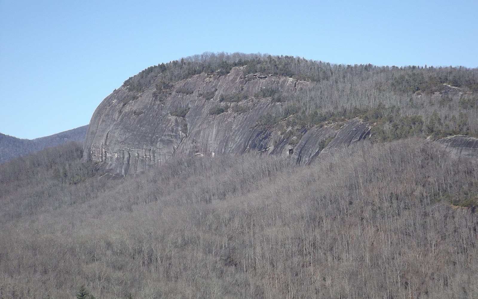
Fire has also shaped the gorge in ways that logging, paradoxically, would have disrupted. The exposed quartzite ridges along the eastern wall carry pitch-pine and Table Mountain pine communities that require periodic fire to regenerate. Both species produce serotinous or semi-serotinous cones — cones that hold seed until heat cracks them open. Without fire, hardwoods gradually shade them out. The gorge has burned episodically, from lightning and, historically, from burning practices of the Cherokee, who occupied and used these mountains extensively before European settlement. That fire history maintained the open pine stands that still distinguish the rim and the upper slopes from the closed-canopy forest below.
The gorge is not fully inventoried, and that is not a complaint, it is a fact about terrain. The steepest sections have never been thoroughly surveyed for plants, and the species lists compiled by the Forest Service and by researchers at institutions including Appalachian State University are acknowledged to be incomplete. Botanists who have worked the interior report conditions that change dramatically within a hundred feet of elevation — a dry quartzite ledge giving way to a seep community, then to a boulder-field with its own microclimate. Each transition carries different species. The inventory problem is the same problem that defeated the loggers: the gorge resists human movement.
This incompleteness is worth naming honestly because it means the gorge is still producing. A site survey conducted here is likely to turn up something not on the previous list. Linville Gorge is not a finished place in the sense of a park whose contents are catalogued and displayed. It is a refuge whose accounting is still being done, slope by slope, drainage by drainage, in seasons when the researchers can get there.
The Linville River exits the gorge and reaches Lake James, a reservoir formed by Bridgewater Dam, built in stages by what is now Duke Energy in the early twentieth century. Above the reservoir, inside the wilderness boundary, the river runs free. It drains a watershed shaped by the Blue Ridge Escarpment — the abrupt drop from the plateau to the piedmont that forces wet Atlantic air upward and wrings it out on the escarpment's face. Linville Gorge receives on the order of sixty to eighty inches of precipitation annually, feeding a river that was still carving when the walls were already this high and has not stopped.
The gorge is the thing you saw from the Parkway and could not quite account for: a gap in the ridge, deeper than the ridge is wide, that the land apparently forgot to fill. It was not forgotten. It was carved, and what was inside it when the carving finished was left there because there was no way to take it.